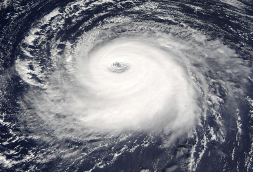
Cyclones, also known as hurricanes or typhoons, are powerful and destructive weather phenomena that capture the attention of meteorologists and the public alike. These swirling systems, fueled by warm ocean waters, can wreak havoc when they make landfall. In this blog, we’ll delve into the intricate process of how cyclones get formed, exploring the atmospheric conditions and mechanisms that give rise to these formidable storms.
The Birth of a Cyclone – Warm Ocean Waters
The genesis of a cyclone begins over warm ocean waters, typically with sea surface temperatures exceeding 26.5 degrees Celsius (80 degrees Fahrenheit). Warm waters act as the energy source for cyclones, providing the heat and moisture needed for their development. As the sun heats the ocean’s surface, the warm air above rises, creating a low-pressure area that becomes the starting point for cyclone formation.
Low-Pressure Systems – The Catalyst
In the tropics, low-pressure systems serve as the catalysts for cyclone development. When warm air rises over the ocean, it leaves behind an area of lower pressure at the surface. The surrounding air, laden with moisture, converges toward this low-pressure zone. As more air is drawn in, a feedback loop is initiated, intensifying the low-pressure system and setting the stage for further cyclone development.
Coriolis Effect – Nature’s Spin
The Coriolis effect, a result of the Earth’s rotation, plays a crucial role in shaping the structure of cyclones. In the Northern Hemisphere, cyclones spin counterclockwise, while in the Southern Hemisphere, they spin clockwise. The Coriolis effect deflects the inflowing air, causing it to rotate around the low-pressure center. This rotation imparts the characteristic spin to the developing cyclone.
Formation of a Disturbance – Tropical Waves
Cyclones often originate from tropical waves, which are elongated areas of low pressure moving across the tropics. These waves can serve as the initial disturbance that evolves into a cyclone. As a tropical wave encounters warm ocean waters, the increased evaporation and latent heat release further contribute to the development of a low-pressure system.
The Birth of a Tropical Depression
As the low-pressure system intensifies and the Coriolis effect induces rotation, a tropical depression is born. In this stage, the cyclone exhibits organized circulation but lacks the strong winds that define more powerful storms. The warm ocean waters continue to fuel the cyclone, and if the conditions remain conducive, it progresses to the next stage of development.
Tropical Storm Formation
When wind speeds reach a certain threshold (39 miles per hour or 63 kilometers per hour), the tropical depression is upgraded to a tropical storm. At this point, the cyclone receives a name, and its structure becomes more defined. The storm begins to exhibit spiral bands of thunderstorms and shows increased organization in its core. The warm sea surface continues to be the driving force behind the storm’s intensification.
Hurricane Formation – The Fury Unleashed
If the conditions remain favorable and the tropical storm intensifies further, it reaches hurricane strength. Hurricanes are characterized by sustained wind speeds of at least 74 miles per hour (119 kilometers per hour). At this stage, the storm develops a well-defined eye, surrounded by a eyewall containing the strongest winds and most intense rainfall. The hurricane’s power is sustained by the warm ocean waters beneath it.
Factors Influencing Cyclone Intensity
Several factors influence the intensity of a cyclone, determining whether it remains a tropical depression, becomes a hurricane, or even escalates to a more powerful category. These factors include sea surface temperatures, atmospheric instability, low wind shear, and the presence of moisture in the atmosphere. Warm waters serve as the primary energy source, driving the cyclone’s intensification.
The Lifecycle of a Cyclone
Cyclones undergo a lifecycle that includes formation, intensification, maturity, and eventual decay. Once a cyclone makes landfall or moves over cooler waters, it loses its energy source and begins to weaken. As the storm moves away from warm waters, it transitions back into a tropical storm and, eventually, a tropical depression. The cycle may repeat if the storm re-encounters warm ocean waters.
Monitoring and Forecasting Cyclones
Given the destructive potential of cyclones, monitoring and forecasting are crucial for early warning and preparedness. Meteorological agencies use advanced technologies, including satellites, weather models, and ocean buoys, to track and predict the path and intensity of cyclones. Timely and accurate forecasts enable communities in the storm’s path to evacuate and take necessary precautions, mitigating the impact of these powerful weather events.
The formation of cyclones is a complex interplay of atmospheric and oceanic conditions that unfolds over warm ocean waters. Understanding the birth and development of these storms is essential for both meteorologists and the communities at risk of their impact. By unraveling the intricacies of cyclone formation, we gain insights into the forces that shape these formidable weather phenomena and the importance of monitoring and forecasting to enhance preparedness and safety.

